
Alameda County ZIP Code Coverage
The ZIP code directory for Alameda County is best read as a set of clusters. The research identifies the areas below, but it does not provide a single official table of every station name or every special ZIP classification. USPS address lookup remains the authority for one live address. The notes flag crossings, rural edges, and places where a city line is not the same as a postal line.
| ZIP Code | Areas Covered | Post Office | Notes |
|---|---|---|---|
| 94501, 94502 | Alameda main island, Harbor Bay, Bay Farm | Verify by USPS address | Two principal Alameda delivery areas |
| 94536, 94538, 94539, 94555 | Fremont north and central, south and Warm Springs, Mission foothills, Ardenwood | Verify by USPS address | Several Fremont-area clusters |
| 94541, 94542, 94544, 94545 | Hayward, Cherryland, Hayward Acres, hills and Fairview, south and west shoreline | Verify by USPS address | Crosses city and unincorporated areas |
| 94546, 94552 | Castro Valley west and central, hills and eastern edge | Verify by USPS address | County pockets and rural edge |
| 94550, 94551 | Livermore south and east, north and west | Verify by USPS address | Rural delivery extends beyond the urban core |
| 94560 | Newark | Verify by USPS address | City cluster |
| 94566, 94588 | Pleasanton central and east, north and west | Verify by USPS address | City cluster |
| 94568 | Dublin | Verify by USPS address | City cluster |
| 94577, 94578, 94579 | San Leandro central, hills and Ashland, Washington Manor | Verify by USPS address | 94578 crosses into Ashland |
| 94580, 94586, 94587 | San Lorenzo, Sunol, Union City | Verify by USPS address | Unincorporated and rural delivery notes apply |
| 94601-03, 94605-12, 94618-19, 94621 | Oakland neighborhoods from Fruitvale and East Oakland through downtown, Temescal, Grand Lake, Rockridge, Laurel, and Coliseum | Verify by USPS address | 94608 overlaps Emeryville and 94611 overlaps Piedmont mailing |
| 94702-10, 94720 | Berkeley, Albany, Kensington, Oakland boundary areas, and UC Berkeley | Verify by USPS address | 94720 is a unique institutional ZIP; special ZIPs need live check |
The table gives a geographic starting point, not a ZIP-wide resident count. A ZIP may serve a place outside a city, and a city may use a ZIP associated with another community. Keep the postal clue tied to an exact address.
Major Alameda County ZIP Clusters
The county's geography runs from Bay shoreline cities through hills, the Livermore-Amador Valley, and rural Sunol. The postal pattern follows delivery routes rather than one clean county grid. Alameda, Fremont, Hayward, Castro Valley, Livermore, Pleasanton, Dublin, San Leandro, Oakland, Berkeley, Albany, Newark, Union City, and unincorporated communities appear in overlapping postal groupings.
That geography changes how a postal directory should be used. A searcher who knows only “Oakland” may need to test a boundary ZIP, while a parcel in Ashland or Cherryland may carry a familiar Hayward line in an older record. A ZIP narrows the delivery clue. It does not identify the city custodian for permits, deeds, or court records.
The county map of unincorporated ZIPs and place names is the most specific local source for the rural and community-name layer.
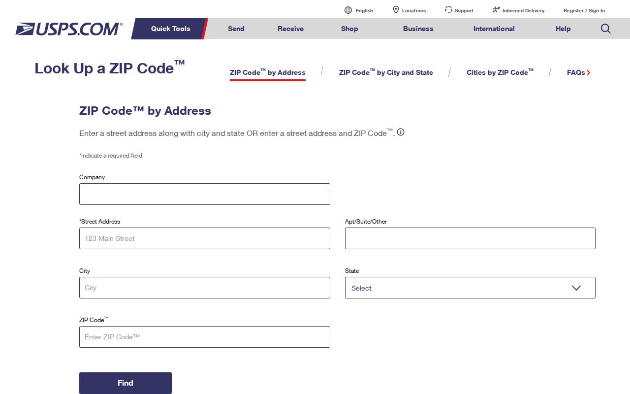
The USPS lookup image shows the proper end point for checking one address after a ZIP cluster has narrowed the search.
2025 Alameda Postal Place Names
In March 2025, USPS adopted official community Place Names for nearly 29,000 unincorporated Alameda County addresses. The names include Ashland, Cherryland, Hayward Acres, Fairview, Castro Valley, and San Lorenzo. ZIPs, APNs, taxes, schools, services, and jurisdiction did not change, and older city names remained deliverable alternatives.
This is a key Alameda County ZIP code directory quirk. A current mailing line can say Cherryland even when an older deed or directory says Hayward. The address did not become a new parcel. Preserve the APN, legal description, and original line, then add the current USPS presentation as a separate field.
The Alameda County address-change notice explains the correction and its limits.
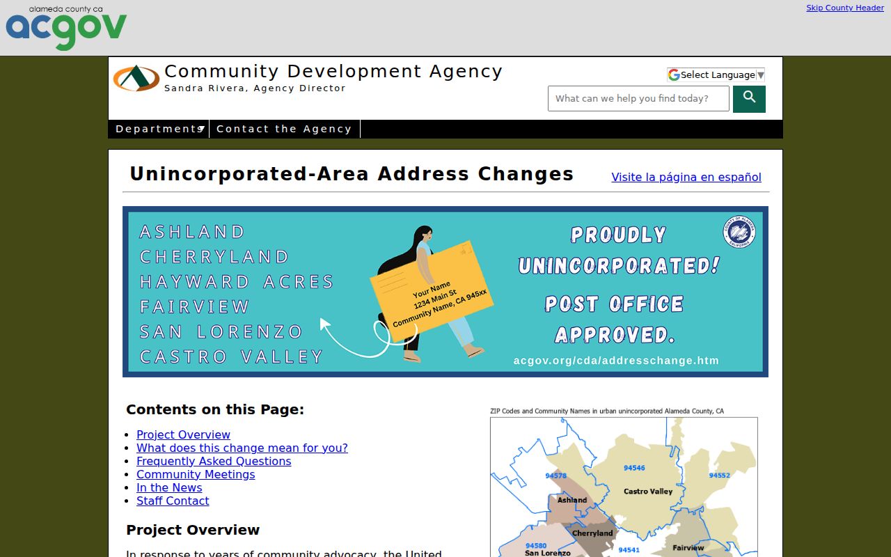
The correction image is useful when a historical record and a current postal lookup appear to disagree.
Alameda ZIP Search Fields and Limits
No research source confirms a county assessor mode that browses every parcel by ZIP. The tax portal is address-first or parcel-number-first. The Registrar's eData service supplies aggregate registration statistics and maps, not an identified ZIP resident list. A ZIP code directory must state those limits instead of implying that a ZIP input returns every household.
| USPS address lookup | One address to a current ZIP and postal presentation; use USPS for live verification. |
|---|---|
| Tax Address tab | Autocomplete address selection, followed by a parcel result; no ZIP-wide browse is advertised. |
| Tax Parcel Number tab | Formatted parcel number with dashes and no leading zeroes; useful after an address is known. |
| Registrar eData | Aggregate registration statistics, party and language history, and map modes; not an individual ZIP roster. |
| My Voter Profile | Authenticated self-lookup for one voter; it is not a ZIP directory. |
The Alameda County tax search and the Registrar statistics page should be read for their actual modes. A ZIP clue narrows the next question; it does not replace an APN or a person-specific record.
The registration statistics source is useful for ZIP and district context without exposing an identified resident list.
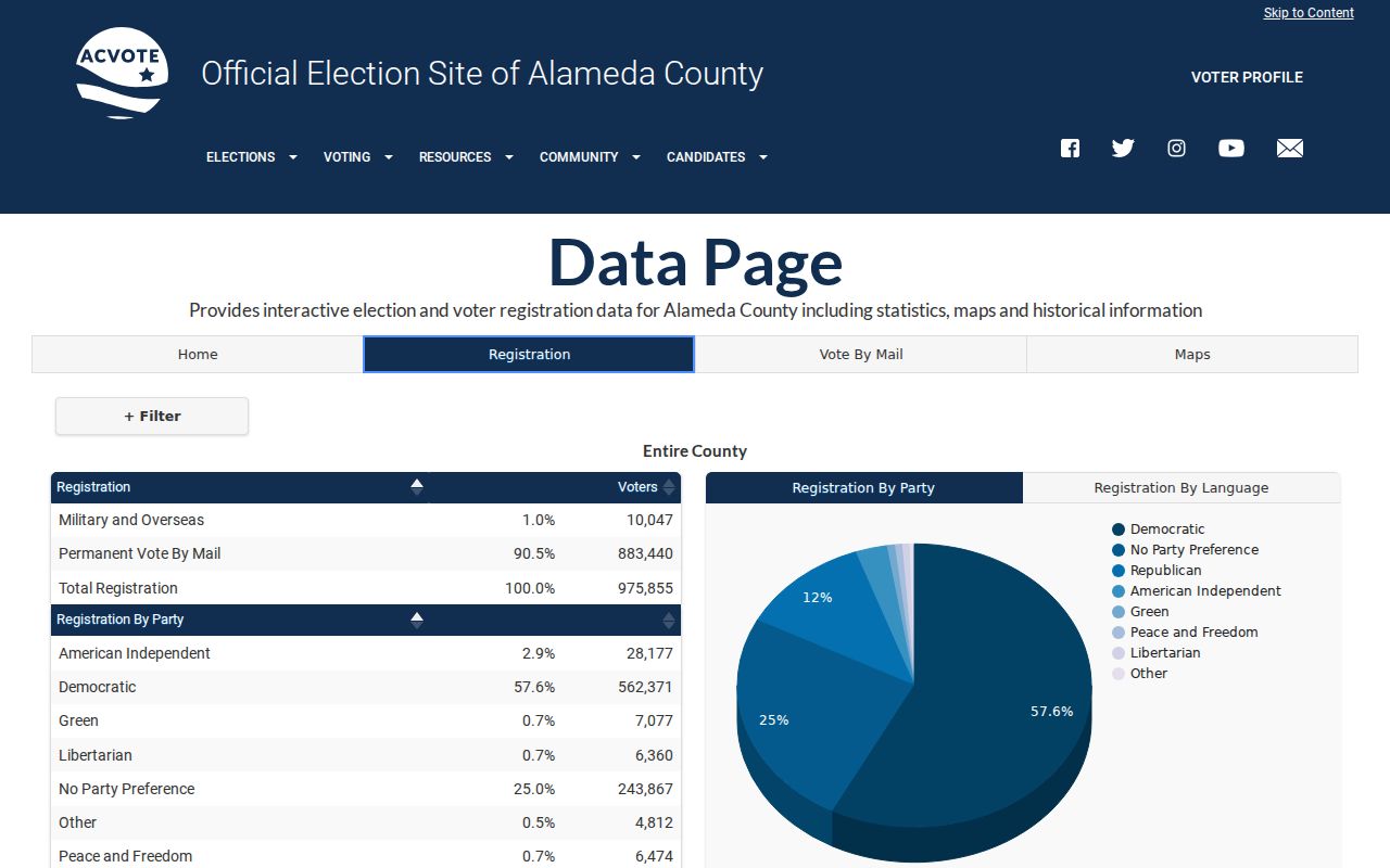
Use the live Registrar service for current aggregate views and keep those views separate from an individual address search.
Finding Alameda Residents by ZIP Code
A ZIP search can support a resident question when the ZIP is treated as a filter for a second record. It cannot act as the final resident source. Start with an exact address if one exists. If only the ZIP is known, identify the community cluster and choose a public portal that actually accepts the next clue.
- Verify one address and its current postal ZIP through the USPS address lookup.
- Use the county Assessor, tax portal, or Parcel Viewer to identify the parcel and APN; do not infer an owner from a ZIP alone.
- Use the APN or owner name in the proper county record, then record the source date and access limit.
- Use aggregate election data for ZIP or district context, not for an unapproved person list.
- Once the ZIP narrows to a street, switch to the Alameda County street directory for the address chain.
This sequence keeps a postal route from being mistaken for a city boundary or a household roll. It also explains why a name-phone search and an address search answer different parts of the ZIP question.
Hayward Labels and Unincorporated ZIPs
Hayward-area ZIPs are a good example of overlapping place identity. The research places Hayward, Cherryland, Hayward Acres, hills, Fairview, and shoreline areas across 94541, 94542, 94544, and 94545. Castro Valley uses 94546 and 94552 with county pockets and a rural edge. San Leandro's 94578 crosses into Ashland, while 94580 identifies San Lorenzo as an unincorporated community.
The local mailing name can change without changing the public record custodian. County deeds remain with the Clerk-Recorder. A permit follows the incorporated city or county jurisdiction. A parcel keeps its APN. A city directory may use the place name printed at the time of publication.
When the same address appears with Hayward in an older volume and Cherryland in a current lookup, preserve both labels and explain the 2025 change. That is stronger than silently normalizing the older record.
Oakland and Berkeley Boundary ZIPs
Oakland ZIP groups include 94601 through 94603, 94605 through 94612, 94618-19, and 94621, with neighborhood clusters from Fruitvale and East Oakland through downtown, Temescal, Grand Lake, Rockridge, Laurel, and Coliseum. The research flags 94608 as overlapping Emeryville mailing and 94611 as overlapping Piedmont mailing. Berkeley and Albany use 94702 through 94710, with Kensington and Oakland boundary areas in the larger group; 94705 includes Claremont and Oakland pockets.
These boundary clues matter when a postal search feeds a city office lookup. A postal city field does not select the correct planning department, court, deed custodian, or election district by itself. Confirm the situs and jurisdiction before requesting a permit or local file.
The Alameda Registrar homepage links election maps and public-record channels, but it does not turn a boundary ZIP into a public name list.
The election gateway image shows a jurisdictional data source that should be read separately from USPS delivery geography.
Unique and PO-Box ZIP Caveats
Some ZIP candidates do not behave like ordinary neighborhood delivery areas. The research flags 94537 as a PO-box classification needing USPS verification, special Oakland candidates among 94604, 94613-17, 94620, and 94622-25, and Berkeley candidates 94701, 94712, and 94720 that require live checking. The research identifies 94720 as a unique institutional ZIP.
A PO-box ZIP may point to a postal box service rather than a street parcel. A unique ZIP may serve one institution. A carrier route is a delivery path within a broader ZIP, not a resident directory. A ZIP+4 narrows a delivery segment beyond the five-digit route, but it does not reveal a household without an authorized source.
Live check first. The county research did not locate one official table naming every station, PO-box, and unique ZIP. Verify the exact address through USPS before relying on a special ZIP classification.
ZIP Code Boundaries vs Alameda County Limits
ZIP codes are USPS delivery routes. Census ZCTAs approximate those routes and can differ. Alameda County boundaries, incorporated city limits, school service areas, tax districts, and court jurisdictions follow other rules. This is why the same ZIP code can cross a city line and why a city name in a mailing address can be a poor guide to the correct record office.
- ZIP code
- A five-digit USPS delivery area used to sort mail, not a legal jurisdiction.
- ZIP+4
- A nine-digit delivery extension that narrows a route beyond the five-digit ZIP.
- PO-box ZIP
- A ZIP used for boxes or a special postal facility rather than a normal street delivery area.
- Unique ZIP
- A ZIP assigned to one institution or a limited address group, such as the research flag for UC Berkeley.
- Carrier route
- A delivery path within a postal area, not a list of all people served.
A strong Alameda County ZIP code directory entry ends with a source label: USPS for the live postal answer, county GIS or assessment for the parcel, and the named custodian for a person or record question.